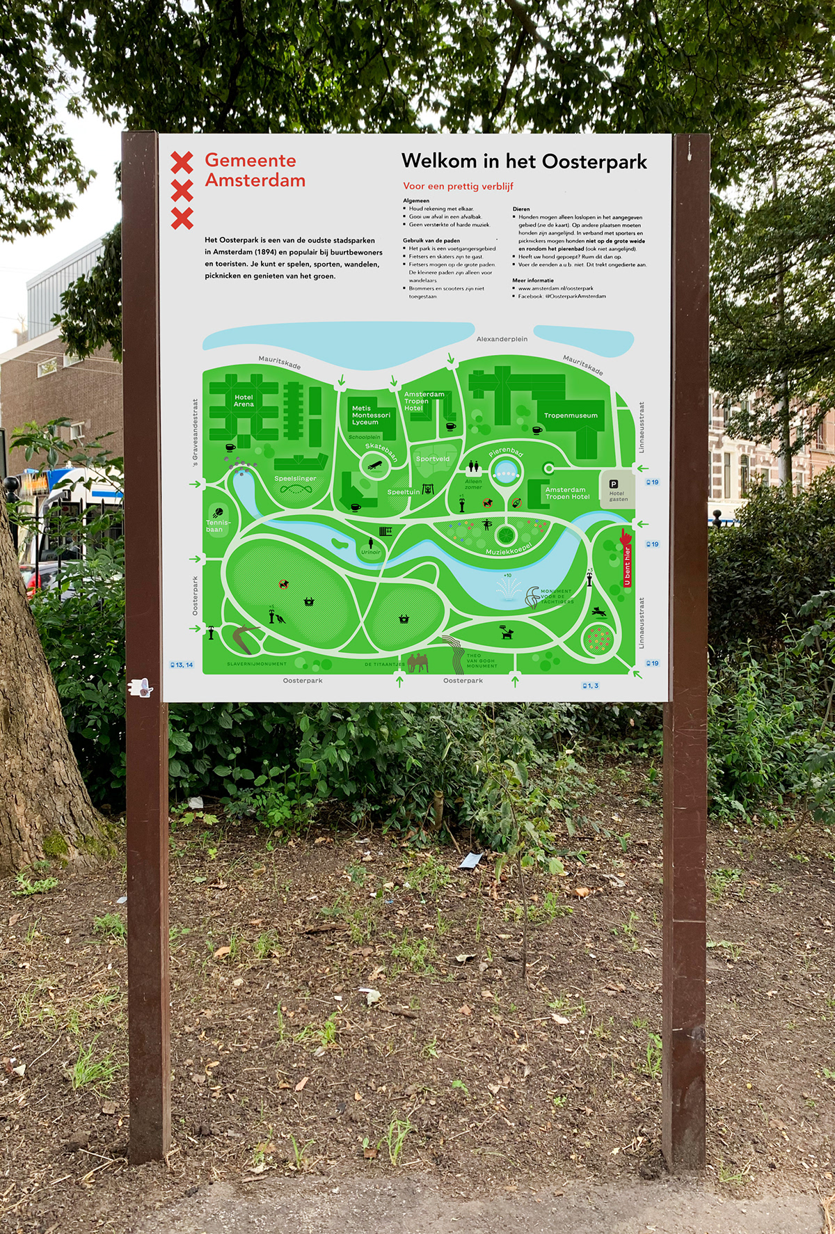
Oosterpark map
From its establishment, "Oosterpark" has seamlessly woven itself into the fabric of the local community. It offers a serene setting for tranquil mornings, leisurely walks along meandering paths through trees and blossoms. Within its borders, one may come across couples ambling beside an artificial water element, and youngsters engrossed in playful activities in inviting playgrounds.

The newly enhanced map quickly acquaints viewers with key park landmarks, services, nature, and sculptures. Pleasant, clean colors correspond to the flora of Oosterpark, inviting visitors to relax on clearings or among the thickets of trees and shrubs, walk across bridges, or play with their pets while enjoying a cup of coffee.

Visual Design
A significant change in the map is the visual design of lines and curves, highlighting the natural character of the area. Connections and semiovals taper at junctions, avoiding clutter. Main roads are depicted with bold lines, while secondary routes appear as finer lines.

For clarity and convenience, the buildings are oriented at right angles. This introduces an additional visual order without significantly altering the topography. The buildings have been streamlined by removing excessive details, reducing the overall visual noise of the map.

Scale
The ratio of objects and distances has been corrected, allowing for a more accurate representation of the scale of the area. Now, visitors can visually assess the distance and time it takes to traverse the park. Some objects have been intentionally exaggerated to denote hierarchy.

Before and after
Information
Each type of information is divided into layers, making the map easier to interpret. Pictograms receive more attention, allowing viewers to quickly identify them. Sculptures and monuments have a distinct bronze shade, setting them apart from buildings and technical structures.

Flowers and greenery serve as pleasant elements, indicating the locations of major flower beds. Each drinking fountain adds vitality. The more challenging the route to a fountain, the more vitality it provides.

Pictograms
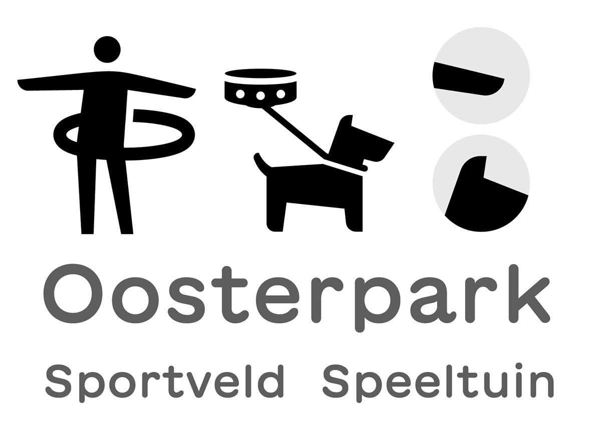
The pictograms have been improved and refined. Additionally, new icons have been added to the set.

For instance, icons representing activities now feature motion trails, and the "no alcohol" sign now adheres to the laws of physics. A bottle replaces the crossing line, and just the percent sign is sufficient for viewers to understand the hint. The sign remains recognizable but has been brought closer to the aesthetics of the main set of icons.

The viewer can discover a series of charming details, such as a drone on a leash, a gymnast with a hoop, and a crow attempting to drink from a fountain. Distinctive slants unite the pictograms into a coherent family, while semiovals are elegantly supported by soft strokes of the font.
For convenience, tram numbers are indicated around the park, and a river channel is marked with adjacent streets labeled, enabling visitors to orient themselves more quickly in the area.

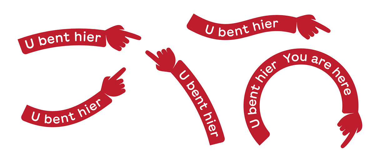
The "You are here" sign is designed in the style of a pointing finger and adapts to any curves.